The Edinburgh of the South

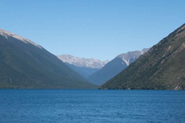
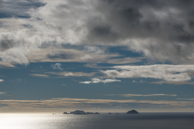
We got up in the dark. When we opened the curtains, the sky was a dark grey and the sea a slightly lighter dark grey.

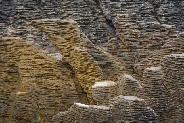
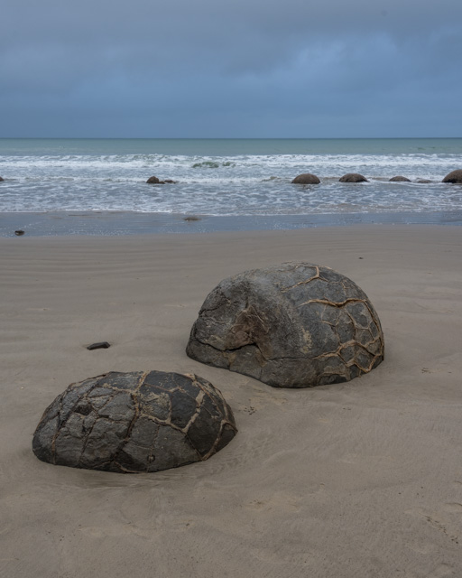
Moeraki is a small fishing village. The name means ‘a place to sleep by day’ but you wouldn’t really want to sleep during the day – we saw great scenery and wildlife on our small cycle ride. The other main attraction there is the Moeraki Boulders on Koekohe Beach.

We took our chance with these – we think we’re coming back here in a few weeks so we opted out of the 7am walk down the beach to the boulders.

Instead, we left the campsite at 8am, and drove 10 mins down the road. This gave us a ten minute window to walk down the beach a little and catch a glimpse of these large spherical rocks scattered on the beach. They were formed in sediment on the sea floor (mud, pebbles and shells) and gradually buried something like 55 million years ago. They were only revealed as a result of shoreline erosion. Some stand-alone; others are in groups. One had imploded. They’re approximately 1m wide, and can weigh several tons.

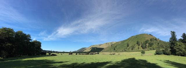
We got back to the bus under spitting rain and drove on towards Dunedin, stopping briefly in Palmerston en-route. The memorial to Sir John McKenzie on the hill was a clue to the origins of the early settlers in this part of New Zealand.

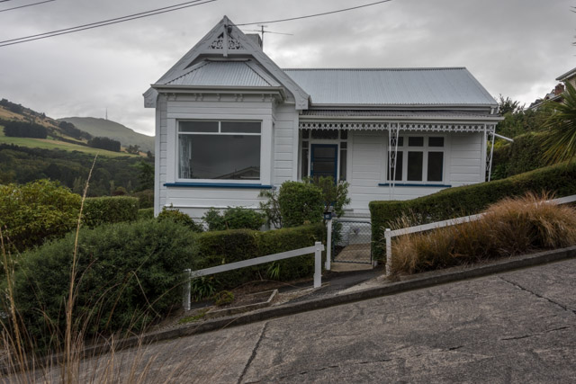
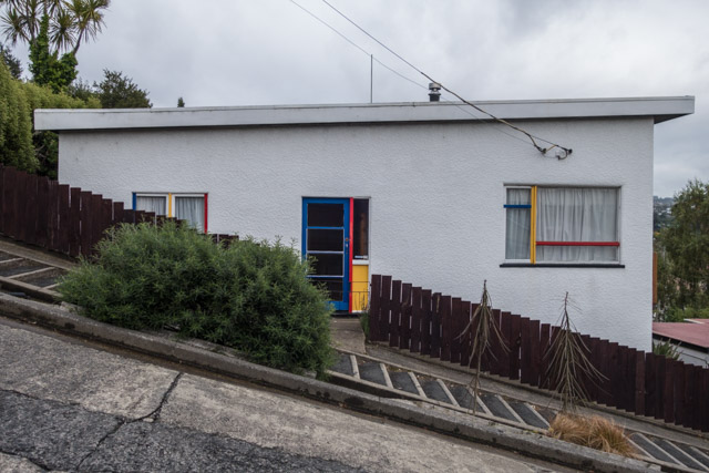
Our first stop on the outer part of Dunedin was Baldwin Street – the steepest street in the world. So, we got dropped off at the bottom; walked up and walked back down. Yes, it is steep and yes, we took photos which show how wonky the houses look against the street. But no, we did not spend £2 NZD to get our certificates.

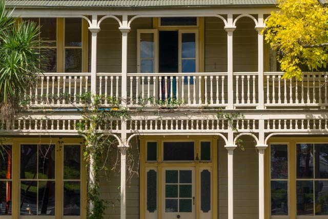
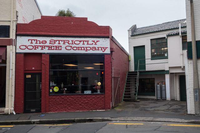
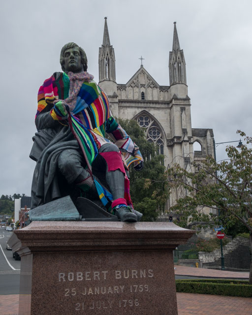
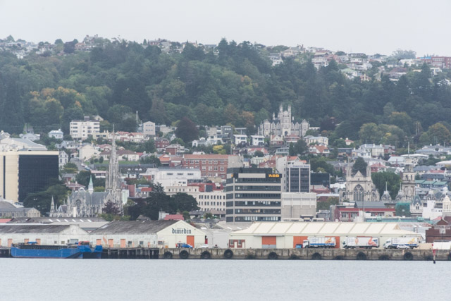
In Dunedin, we had just over four hours to ourselves… enough time to have a decent look around. We started with flat whites at Strictly Coffee Company; it was good to have the time to sit down and people-watch. And then, we went on Mission Sightseeing. The gothic Victorian buildings around the Octagon (the central square) were very reminiscent of Edinburgh. Dunedin has its own tartan. And outside the cathedral, there’s a statue of the poet Robert Burns. Presumably, he was recently yarned up as we’re heading into autumn.

According to Lonely Planet, Dunedin is derived from the Scottish Gaelic name for Edinburgh: Dùn Èideann. The city was founded when a group of breakaway Presbyterians – passionate about their Christian beliefs and their identity as Scots – were looking for a ‘vigorous new community where members of the Free Church of Scotland could live out their faith and advance themselves’ (text from the Toitū Otago Settlers Museum).

There was an organ concert in the cathedral when we visited; the organ is meant to be one of the finest in the southern hemisphere.

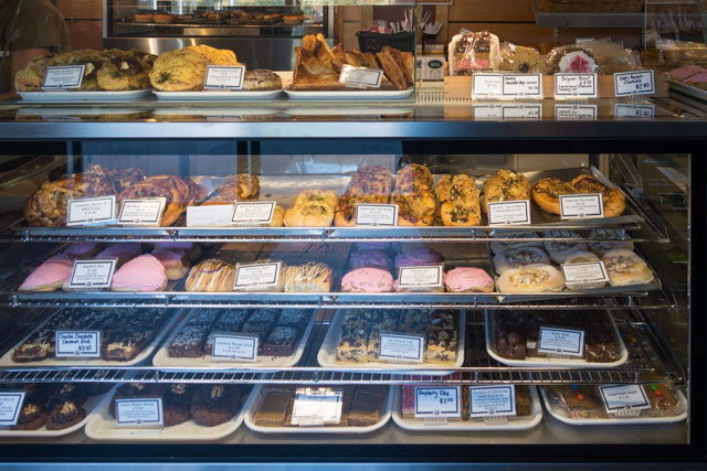
With so much time on our hands, we made for the Dunedin Public Art Gallery. All the art galleries we’ve visited so far have had great art, and they’re free. Our usual strategy worked well – we went to the information desk, stated how long we had and the woman manning the desk gave us her top five must-dos.

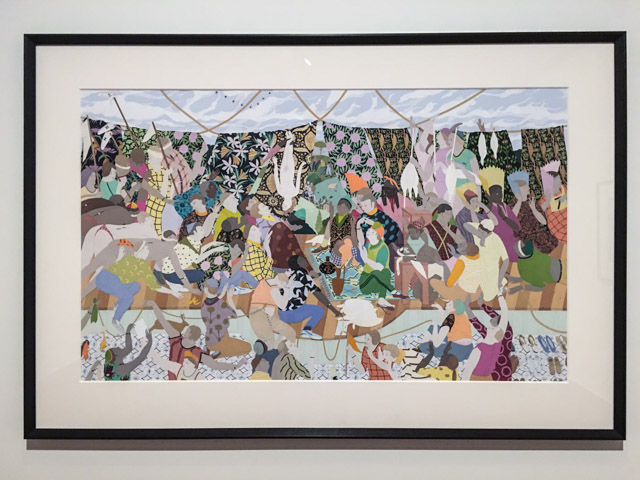
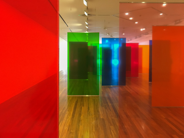
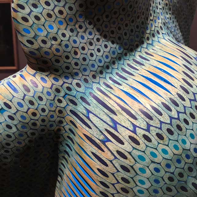
We started with Kushana Bush, a New Zealand artist whose work is intense. Her works are all extremely demanding and full on. She is known for producing highly detailed paintings, with multi-ethnic characters and open-ended narratives. Looking at one of her painting in depth could take hours; they are complex and often they contain references to many historical manuscripts. The next gallery was taken over by Australian artist Rebecca Baumann. The space contained huge colourful Plexiglas panels. We really enjoyed how the colours took over the room and how they mixed depending on where you stood. The works of New Zealand artist Nicola Jackson were contained in a small gallery and that was insane. The works – all with anatomical subjects – and the colours were all too much for us. They reminded us broadly of the works of Frida Kahlo we saw back in Mexico. We had just enough time to take in the permanent exhibition which had a few treasures, including a sculpture made of pencils that Andy can’t stop talking about.

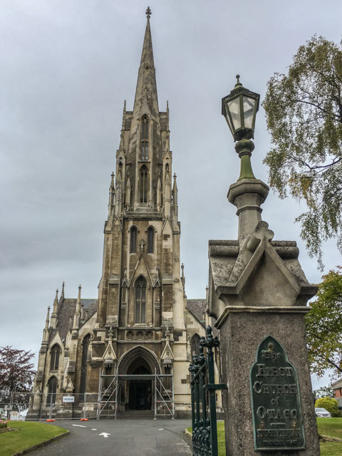
Leaving the gallery behind, we walked to the first church built in the Otago region. The inside is quite plain and vaulted which we weren’t expecting from the tall spire. It was built in 1848 with the arrival of the first permanent early settlers, pious hard-working Scots.

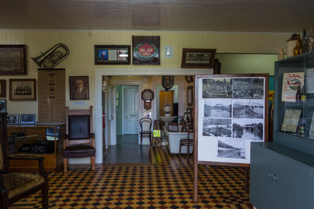
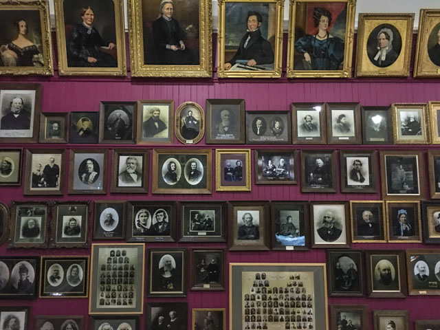
We had about one hour in the Toitū Otago Settlers Museum. Highlights were many but we concentrated on the history of the settlers. We’ve been fascinated by this question since we got to New Zealand: what made these people leave everything behind and embark on a three month sailing to New Zealand? Poverty? The prospect of a better life? Gold (from 1861)? But it’s clear too that the New Zealand propaganda machine had been working overdrive. They arrived and faced hardship. It would all come together for them if they were prepared to put a lot of hard work into it. One of the rooms contains floor-to-ceiling portraits of early settlers. Each wall has a dedicated machine with all the portraits on that wall and by selecting a portrait, you could learn the name of the person and when they made the journey across. There’s a reproduction of a passenger-ship cabin and some artefacts. There were a few other displays which caught our eyes such as the Maori and the old transport sections.

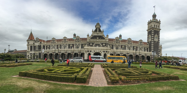
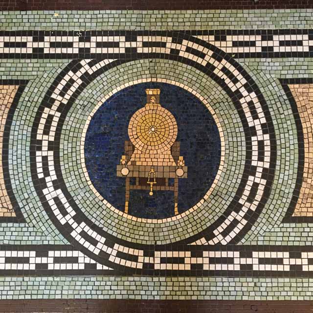
Dunedin Railway Station, a few minutes away, is the most photographed building in New Zealand and allegedly in the southern hemisphere. The interior is well preserved.

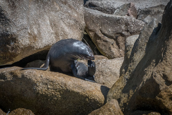
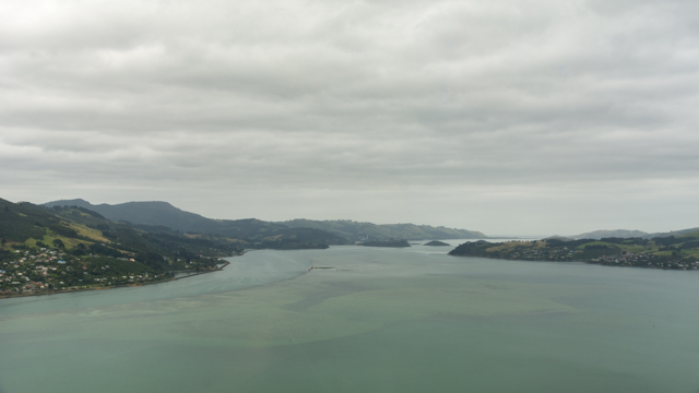
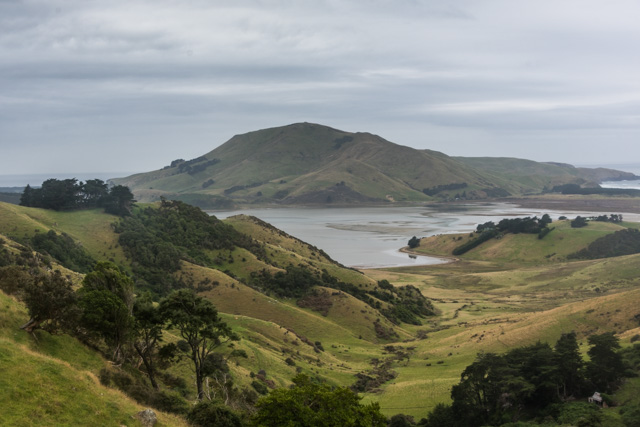
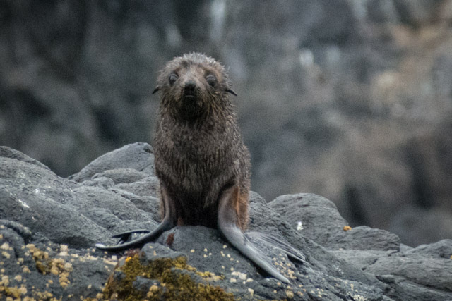
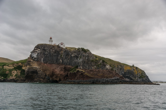
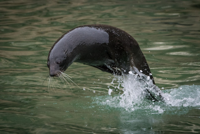
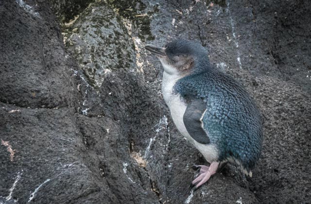
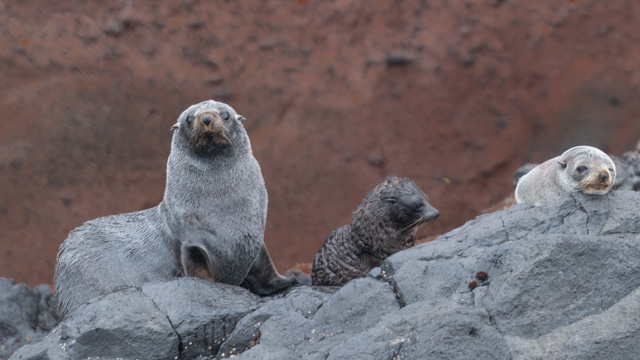
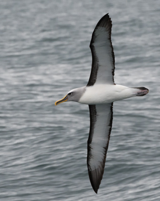
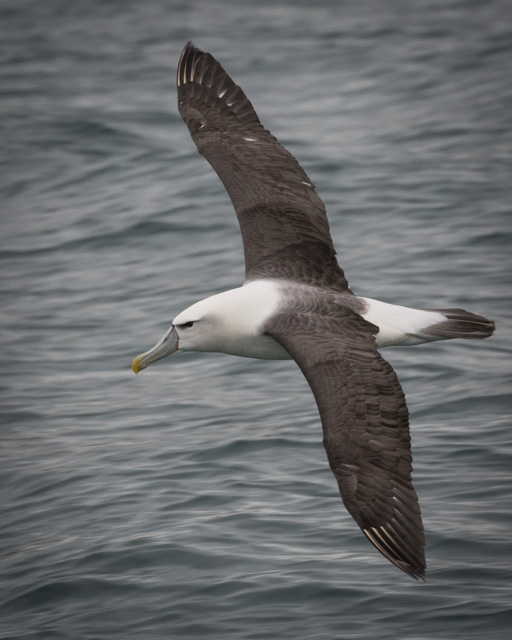
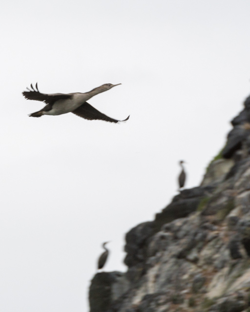
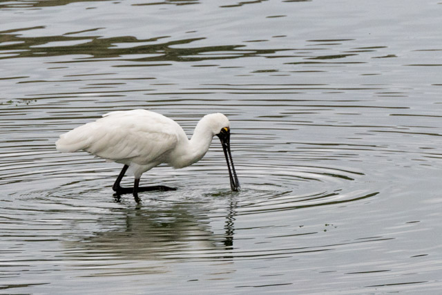
And this is where we were picking up our tour for the afternoon. After a 40 mins drive along the Otago peninsula, we boarded our boat for a wildlife cruise. We saw so much: royal albatrosses; white-capped albatrosses; Buller’s albatrosses; fur seals; New Zealand sea lions; white-fronted terns; cormorants; a royal spoonbill and a handful of little blue penguins!

Our camp was in St Kilda, on the outskirts of Dunedin. After dropping our bags in our cabin, we walked to the Esplanade in St Clair for dinner. This was the first time in weeks we had dinner in a restaurant, with proper cutlery and everything. The sea outside was wild. There was a shark warning bell on the promenade, the surf was so loud we wondered the futility of it.

A night with Bob Marley


Tonight is our second (and last) night camping. Our tent is Bob Marley. Our bush camp is basic – no facilities apart from long drop toilets. We’re camping by Lake Pukaki, with a great view of Mt Cook.

We arrived at camp very early. This gave us time to pitch the tent in very hard terrain. Andy had to use a big rock to get the tent pegs in. We’re expecting high wind during the night, so the pegs had to be secured properly. We managed to get hold of two mattresses each, and a spare sleeping bag, so we were hopeful of a decent night’s sleep.

We had loads of time to take in the view – a panoramic view of the lake – before dinner. I even managed a swim in the lake.

Dinner was quickly consumed and we rushed back to the lake for the sunset. We were treated to a spectacular sunset – a light show of colours and reflections. Everybody had that feeling that you get when you witness something incredible – wow, aren’t we lucky to be here for this; what a show… just for us. Absolutely amazing, and I’m not even a sunset person.

We’d left Rangitata at midday. We’d spent the night on a sheep-shearing farm, and our room was one of the rooms that the sheep shearers use during sheep shearing season.

We were woken up when the white water rafters left for their excursion. Andy got dressed quickly and walked down to the river to capture the mist. The light was soft.

After breakfast, we went to explore the sheep-shearing building. There was wool left behind, and tools. It looked at if it had only recently been used, and at the same time, it had that abandoned feel to it.

From there, we wandered down to the Holy Innocents Church. It is currently being repaired following the earthquake. Many of the stained-glass windows had pastoral scenes with sheep, unsurprisingly.

The churchyard was fascinating. Many immigrants taking their chances in the new world. A great variety of people. So many stories there.

On the road. Not much driving today.

We passed through the pretty town of Geraldine – lots of enticing cafes, restaurants, bars and shops.

Our first stop was the small town of Fairlie… where everything is Fairlie something or other. This was a convenience stop, but we had time to pop into the Fairlie Bakery for our daily flat whites and baked goods.

Through Burkes Pass. The views and colours, as we drove through Mackenzie Basin, reminded us of some of the landscapes we saw in the Christchurch Art Gallery the previous day.

I’d been looking forward to our next stop – the Church of the Good Shepherd. It sits right next to Lake Tekapo but what online photos had failed to prepare me for is the hordes of tourists and the fact that it is by the main road. Having said this, it is a lovely church, and I still managed to get a few peaceful moments to reflect. Behind the altar, there is a panoramic window, which perfectly frames the wonderful view of the lake and the mountains. This is very much an active church and no photos were allowed inside. The lake was pretty special too and Andy enjoyed the huge vistas.

See. New Zealand can be a great place to be when it wants to!

30 Temporary; 50 Temporary

Lazy morning. After breakfast, Andy managed to upload yesterday’s post (the internet was free at the Sequoia Lodge and Backpackers and so dead slow). We only have nine days left on the bus so it was time for me to start looking at what we’re doing next and send a few emails about.

We had time to walk into Picton, or more accurately to the Picton Village Bakkerij. The place was filled with goodies. We picked a few treats to go (tough decisions had to be made, as well as our daily flat whites; these are definitely keeping us going.

We left soon after 11am. Our convenience stop was at Wairau Valley. Just outside the church, there was a little book swap library by the side of road and it was filled with many good books but mine’s in my rucksack so my book swap will have to wait.

We drive through Marlborough Country, vineyards either side of the road. We climbed a little, driving through the Six Mile Scenic Reserve and then Nelson Lakes National Park.

We stopped for lunch at Kerr Bay by Lake Rotoiti. Andy went on a small loop walk. I went for a refreshing swim.

We’re using an alternative road today. Our original itinerary was for us to spend the night in Kaikoura with some pretty amazing wildlife viewing options for tomorrow. But following the Kaikoura earthquake last November, the road is still closed and the itinerary was amended. The road we’re travelling on used to have little traffic. It had 40 trucks on it a day, it now has 400. This means that they are frantically trying to expend it, so lots of road works are going on. Endless road works. Often, our speed is regulated to 30 or 50. Where sections of the road used to be one lane, this is now extended to two lanes. They’ve got Bailey bridges from The Great War out of storage and these are working as second lanes over rivers. They reckon the route to Kaikoura will re-open by Christmas, just over a year after the earthquake. But rumours say it will take much longer.

The sky’s blue. There is not one cloud.

The landscape is rural and agricultural, against a mountainous background.

The quiet town of Murchison, where we had a convenience stop a few weeks ago, is now seeing a lot of traffic passing through. We had a twenty mins stop there today too, and we discovered Dust & Rust – full of amazing vintage and antique stuff. I was tempted by an English-Maori dictionary but the $59 NZD price tag was prohibitive. Instead, I got a lemonade ice block.

We crossed the Lewis pass and got spectacular scenery.

We arrived in Hanmer Springs around 7pm. We got our swimmies, and rushed to Hanmer Springs Thermal Pools. The complex closes at 9pm so we had 90 mins going from pool to pool – some geothermal ones, ranging from 33c to 42c; other pools had cool features like the Lazy River where the current carried us round a course, and the pool where every five mins a bucket of water would fall over.

We walked back down the main street, located our cabin and dumped our bags and returned to the main street. It was near 9:30pm by then; the first bar we went into was closing (we’d been hoping to try local wines there). We ended up in Fire and Ice – a much larger bar attached to the Mac’s Brewery – where we had a couple of beers.

Him and Her

Andy and I were always going to do different things today.

Well, originally, we weren’t. The idea was to do the Tongariro Alpine Crossing – one of New Zealand’s great walks and rated as the best one day walk in the World. ‘Towering mountains, turquoise lakes, sparkling rivers, lush rainforests and lunar landscapes. […] awe-inspiring mountain backdrop’ (quoted from Flying Kiwi’s itinerary).

Unsurprisingly, the night before we got the news that the crossing wasn’t going to happen. Too windy up there – wind speeds of up to 100km/h were forecast for the highest parts. Unsafe. Andy was very disappointed; he’s been looking forward to it. Following our walk to and from Cathedral Cove, Andy had made the call. I wouldn’t be walking the Tongariro Alpine Crossing; my knee was too sore.

There was an alternative day walk on offer and Andy signed up for it.

Him

5:00 alarm – it was still very dark and cold. Quick shower, got my stuff together and put on all the clothes I had. Grabbed some breakfast then boarded the bus for the 40 minute drive to Whakapapa where the walk started.

We were given a map but our walk was only about 2cm long on it so not too helpful. The paths are very well marked and maintained so a map wasn’t really necessary.

The sun was still just below the horizon when we started; the highest peaks just catching the first rays. To start with, the walk climbed gently across some lava fields; some low cloud on the horizon was keeping the sun from us.

After a couple of miles we crossed over a small ridge and there was the wind. Any jackets that had been undone were soon zipped up again. The path carried on for a few more miles over gently undulating ground then started to climb more steeply as we got to the first of the two lakes we were aiming for.

Lower Tama Lake is a brilliant blue colour reflecting the sky. It’s a volcanic crater lake, surrounded by the remains of the crater and some scree slopes.

The hardest part of the walk came next, a steeper climb to the Upper Lake. At one point the wind suddenly got stronger, two people were blown off their feet, no harm done. The upper lake is much darker than the first, nestling between steep scree slopes with mist and cloud hanging around the peaks above it.

The return walk was mainly in sunshine; the landscape looked quite different. For the last hour, we took a different route to see Taranaki Falls – an impressive 20m cascade and then walked back along the river valley to Whakapapa.

There’s one café in the town, their garden tables were the perfect place to enjoy a flat white and sit down for a bit. It was hard work at times but overall a very enjoyable 11 miles.

Her

I heard Andy get up, and I heard him leave the house. I didn’t think I’d go back to sleep but clearly I did. I woke up around 8:45 (ooops). After breakfast and after checking out of the house, I borrowed a bike and went off to cycle the Tongoriro River Trail. I was given a map of the trail, but I didn’t quite get the instructions on how to get to the trail… so that was interesting. But I got to the river, and had a wonderful time. I made a number of stops to look at the river – there are many cool names on the trail such as Breakfast Pool and Never Fail Pool. Sadly, I had to be back at camp before 12.30, so I didn’t have time to go as far as Silly Pool. The trail was flat, a little hilly, a little gravelly and sometimes muddy. On my way back, I made a few more stops, and got chatting to a man who was inspecting the Major Jones swing bridge. It is inspected once a month. I joked that I should let him finish his inspection before crossing the bridge. Funnily enough, he found that one of the cables was too loose.

Back at camp, I had my lunch on a pallet converted into a swings and soon enough, it was time to go and get the others.

About forty minutes drive away, through some absolutely out of this world scenery, we met up with Andy and the rest of the group in Whakapapa Village, on the slopes of Mt Ruapehu. Simon had chosen to drive the slower but scenic route to the meeting point, and I’m grateful to him for that. We had amazing views of Mt Tongariro, Mt Ngauruhoe and Mt Ruapehu.

Him and Her – back together

After forty mins or so, we stopped in Taihape. We had just over 20 mins. We walked down to the main street and I popped into the i-SITE and got a town walk leaflet. We had enough time to see nine of the town’s sixteen highlights. Two of the most memorable ones – the Court House which was built around 1906, probably ‘spurred by the frequent unruly keg parties held in local paddock and the King’s (Majestic) Theatre which first screened films on Sunday nights from 1913. Taihape is also the Gumboot town. Remember Dargaville’s the kumara capital of New Zealand? Well Taihape is all about gumboots. There is a massive gumboot at the entrance of town. Just a little earlier, we’d passed Ohakune… and that town is all about carrots. Here’s what Lonely Planet has to say about it: ‘Expect to see carrots crop up all over Ohakune, for this is indisputably the country’s carrot capital. Carrots were first grown in the area during the 1920s by Chinese settlers, who cleared the land by hand and explosives. Today the venerable vegetable is celebrated during the annual Carrot Festival, and immortalised in a roadside tribute – the impossible-to-miss Big Carrot, erected in 1984′.

An hour or so later, we crossed the town of Bull. Now, they have a thing going on there. All town shops, restaurants and establishments have ‘bull’ in their names such as a deli advertising the fact that they sell ‘delect-a-bull’ food, or the police station where you can find ‘const-a-bull’. No kidding.

Dinner was fish and chips on Paraparaumu beach. We’d placed the order from the bus and we collected this huge box full of fish, chips, vegetable rolls, potato fritters, donuts and pineapple rings. The perfect food to re-fuel the walkers. A nice breezy walk on the beach after dinner and onwards to Paekakariki where we’re spending the night.

Chaos, chaos and more chaos

As we boarded the bus this morning, I told Andy I thought we could just stay in Hot Water Beach. Digging hot pools on the beach is fun, and we could go back to Cathedral Cove, exploring the other coves on the way. And the campsite’s great. This was our third Top Ten Holiday Parks campsite, and it was perfect. Our cabin was amazing; the reception sells beers from local breweries; there was a huge fun inflatable pillow to jump on and it was very close to Hot Water Beach.

Andy got up early to se the beach again. We left camp at 8:30 and made our way back to Tairua where we had a twenty mins coffee stop. Being 9am on a Monday morning, all but two coffee places were closed. The group went to the one nearer the bus, we went to the other one and got two average flat whites.

Back on the road, it threatened to rain when we crossed the pass. A bit of the road was sectioned off due to a small landslide. The heavy rain we’ve had continued to make the news as 50mm of rain fell in West Auckland in just one hour.

We stopped at a viewpoint and it was lovely to feel the warmth of the sun.

We drove to Paeroa and let six cyclists out. Five minutes down the road, Holly asked Simon to go back as she’d sent the cyclists the wrong way (‘All part of the fun”). To be fair, she’s had little time to research a cycling route for them as the road we were on this morning was a detour; the normal road’s closed due to flooding. We caught up with them and what’s even more funny is that they had cycled through a sign informing them that the cycle path was closed due to flooding, so they couldn’t have carried on going the wrong way anyway. With that sorted, we got back on the road and made our way to Te Ahoha (which means The Love). We only had an hour until the cyclists met us there so six of us popped into the i-SITE, got maps and walked up the track to the waterfall. The track was well marked, up to the point when it wasn’t. We continued and saw a river with a small waterfall (we were expecting a larger one). The track continued across the river, but it was quite deep due to the recent heavy rainfall. We retraced our steps, trying to figure out where we’d gone wrong. We still don’t quite know.

We then thought we’d have a look at the town’s geyser. The map indicated we were in the right place and we laughed when we realised that it was the huge slab of concrete near us. The geyser goes every 40 mins, and we were confident we hadn’t missed it by trying to find the waterfall as there was no fresh water about so we sat down and waited. ‘Is that it?’ we exclaimed when it geysered. Yes, that was a pathetic attempt at being a geyser.

On the way back to the bus, I popped my head through the door of the museum. I had been tempted to do that instead of the waterfall walk but the review in Lonely Planet wasn’t that great. By the little I saw, I think they’re wrong and that would have been a better option.

The news greeting us back was that the cyclists weren’t back so we had a bit more time. Andy and I set off to explore. Te Aroha was a booming thermal and mineral spa town in the early twentieth century. There are still many historical buildings and they are well maintained. There are also some nice looking cafes, restaurants and antique shops. Tourists still come to experience the spas. I really enjoyed my time there, and wished we’d had more time to look around. Eventually, however, all cyclists were accounted for and we left 30 mins later than planned (one of the cyclists had made too many photo stops along the way).

It was a race to Matamata where we were picking up a new travel buddy, and where all but seven of us got off for their trip to Hobbiton. We only had 20 mins in Matamata to get lunch. Andy and I found a cafe and sat down to enjoy our sandwiches and smoothies when Holly came racing towards us, asking if we could get it all to take away as two people had missed the bus to Hobbiton and we’d have to drive them there. The reason they’d missed the bus in the first place is that despite being told that the bus was leaving at 2pm, they heard Holly telling us we’d have 20 mins for lunch and thought that applied to them too. We got there ten mins after the tour started so hopefully they didn’t miss too much.

The rest of us continued on the road to Rotorua. We had two hours to explore. As soon as we got off the bus, we could smell the rotten egg smell the town’s famous for. Rotorua is renowned for its geothermal activity and Maori culture. There are many bubbling mud pools and geysers – in town, near town and on the outskirts of town.

We decided to walk along Lake Rotorua to Sulphur Point and along the Lakefront. We did a loop, following the boardwalk path. Hot bubbling water and steam. The lake is rich in wildlife – we saw black swans, New Zealand Scaups, some pied shags and a few other feathery things.

Back in town, I had just enough time to get my dinner for later. It was close to 5.30pm by then so a few places were closed – or hadn’t opened today.

Back at the bus, we got the news that our departure time would be delayed as we were missing a passenger. Of the seven people who didn’t go to Hobbiton, three went on a luge thing adventure. Two of them had cycled back to the meeting point. The third person was to get the bus there. In the end, Holly sent Simon to camp so people could set up their tent and she would stay behind and try to figure out what had happened to the missing one.

Our arrival at camp coincided with the Hobbiton people being dropped off. The group had 20 mins to put their tent up as they were due to be picked up at 7pm to go to Tamaki Maori Village. The Maori experience is supposed to be authentic (read not too touristy). The village is in the Rotorua forest and guests are formally welcomed into the sacred grounds and taken through Maori art forms, ancient rituals and Maori traditions, signing and dancing.

Turned out that the missing person had decided to walk to the meeting point (about 4kms) and had misjudged their walking ability! Grumble, grumble. A few people are not happy with the chaos today (most of which isn’t Flying Kiwi’s fault). This group’s not gelling and it’s quite funny to see.

After seeing Andy off (he went to the Tamaki Maori Village), I went in the hot pools we have on site. That was nice and relaxing. I got chatting to a woman who just got married on Saturday. Her wedding was delayed by four hours due to the rain, and the marquee (which had been beautifully decorated) was blown away. She was cool about it all and was really enjoying the hot pools.

Back at the cabin, I had my dinner and spent the rest of the evening reading my book. Pure bliss.

The perfect end to a truly chaotic day.

It didn’t rain today and we got out of the bus to do stuff so yeah!

Sunny afternoon

The heavy rain continued overnight and as we drove towards Opononi this morning, we came across many flooded fields, rivers having burst their banks and flooded roads.

Whilst the majority of the group went sand dune boarding, we went to The Landing Café for brunch – excellent scrambled eggs on toast with mushroom on the side, smoothies and flat whites. We’d skipped the team breakfast again this morning – a small price to pay for more sleep time.

The woman at the i-SITE (these are tourist information places) reckons that the rain has now stopped, and the forecast’s for 100% humidity.

Travelling through the Waipoua Forest, we stopped to take a look at a large Kauri tree. We had to clean and spray our shoes on the way in and on the way back. This is to stop spreading the dieback disease which is killing the trees.

The next stop was at the Kauri Walks, not far away – a series of walks to go and see various old Kauri trees such as the second or seventh largest Kauri trees in New Zealand. With the timeframe we had, we constricted ourselves to the Four Sisters, a group of four Kauri trees rooted together. The walk through the forest was lovely with the green popping out from the rain and I can confirm that the lady at the i-SITE wasn’t kidding. Humidity is high.

Just as we left, the rain started again. Later than the last few days so we took that as a sign that things are improving. Our timings for New Zealand were good, summer going into autumn. But this definitely feels like autumn going into winter.

Dargaville, where we had our lunch stop, is the kumara capital of New Zealand. From my time in the Kerikeri library yesterday, I now know that kumara is the Maori world for sweet potatoes. That’s its claim to fame. It produces two-thirds of the country’s sweet potatoes. Apart from that, there isn’t much else especially since the demise of the Kauri timber and gum exports. We’d planned to skip lunch (that’s why we had brunch) and were aiming for the Dargaville Museum.

It’s an award winning museum – allegedly – and a pretty good regional museum. There’s supposed to be a gumdigging display, Maori and musical instruments and a model railway. The museum also has the masts of the Rainbow Warrior. That name brought back many memories – mainly of demonstrations outside the French Embassy in London in the mid-90’s. But of course, it wasn’t to be. The museum is out of town. We could have been dropped off there, but it was a 38 mins walk back to the meeting point and our lunch stop was one hour.

Andy went off the explore the waterfront, and I took to the streets in search of historic buildings. We did see the masts from a distance, so that’s something. The rain had eased off by then and was replaced by a scorching sun. The North Face waterproof trousers we’ve been wearing for days were instantly uncomfortable.

Back on the bus, we drove on to Orewa where we’re setting camp right by the beach. We celebrated our arrival with a leap of joy; it hadn’t rained for two hours. Our cabin is literally as far as it could be from the group. It has a bathroom, a kitchen, a bedroom, a lounge and an outdoor terrace. We had an early dinner as some people were keen to go swimming. Andy and I walked along the beach; we’re only about 40 mins from Auckland so this is a commuting town, and the campsite definitely has a lot of permanent holiday caravans. The beach is quite mucky – lots of seaweed remains, probably from the bad weather we’ve had.

Back at the cabin, we wrote our diaries (we’re a little behind) and watched the end of the film we started yesterday.

Random musings and observations:

  • It’s a Kiwi thing to walk around without shoes on. Wherever you are. On the road, in towns, everywhere
  • There are lots of classic cars about. These are not just to show off at the weekend, people drive them all the time
  • There are 30 million possums in New Zealand (human population: four millions). They are hated with a passion, mostly due to the huge impact they have on the ecosystems. The damage to native plants and forests can be seen all too clearly in many areas. Possums ignore old leaves and select the best new growth. In some areas they have eaten whole canopies of rata, totara, titoki, kowhai and kohekohe
  • Letterboxes. These are generally at the end of drives, on the main roads. There seems to be a lot of work involved in making your letterbox as quirky or individual as possible
  • We have seen more moos then baas so far, and plenty of beehives – manuka honey being a big thing here (and as an export)
  • There are boards by the side of the road with pie charts. These can tell you the daily risk of fire, flooding or facial eczema – going for low to extremely likely. An arrow indicates the risk level for the day. Is that someone’s job? Daily?

Day 100

I’m pretty sure New Zealand hates us.

We woke up to sunshine in Auckland this morning. The troupe was in high spirits.

Andy and I wandered over to The Shaky Isles for breakfast. Really tasty food and coffees. We’ll definitely pay the place another visit when we’re next in Auckland.

Fact of the day. There are more people in Auckland than the whole of the South Island.

After collecting our bags from the hotel, we walked to the meeting point. As we boarded the bus, we said goodbye (again) to the guys who left the trip yesterday – they’d come to wave us off. And we welcomed four new people onboard.

We headed north over the Auckland Harbour Bridge. We were not even half an hour away from Auckland when the sky turned grey. As we progressed North, the grey turned to heavy rain… and this is the forecast for the next two days. And this coincides exactly with the number of days we have in the Bay of Islands.

The plan for today was to head north to Northland towards the golden beaches and warm waters of the Bay of Islands. Our first scheduled stop of the day was meant to be at the beautiful Uretiti beach. We could swim (if we were keen), play frisbees or take body boards to the sea. Chill, and relax. When we got to Uretiti beach, we couldn’t even see it, so we pressed on.

We stopped in Wellsford for lunch. As it was relatively dry, we picked up a few bits and pieces to eat in the bus later, and instead walked down the high street, and too late came across the Albertland Heritage Centre. We poked our head round the door. We were 22 mins into our 30 mins stop so we sensibly turned back. It looks like a good local museum, full of pioneer-era stuff. One for next time? Thinking about this further, maybe not. Most towns around here have similar museums, so we just need to make sure we catch one of them.

We spent the next couple of hours in the bus talking about our options for tomorrow. Bearing in mind the weather, do we want to pay a substantial amount of money to potentially see not much at all? Or do we play it safe. We’re torn. The safe option could be fun, but it would mean missing out on the scenery around here… which is supposed to be outstanding. Or do we take a chance and who knows?

Which is funny, in a non-funny way. Because they’ve had a drought up here. And locals have been praying for rain (yeah, it worked). The communities further north are poorer, and the infrastructure not so good. Most people are not connected to water mains, and get their water from tanks. So the rain is welcome. I chatted to a woman at lunchtime. She was happy the rain was on its way. I told her I understood but I wished it’d held up another three days. The rain is making front page news.

Back on the bus, Holly lifted our spirits by playing rain-themed songs and choruses of ‘it’s raining men’; ‘always look on the bright side of life’ and ‘it’s a beautiful day’ amongst others soon filled the bus.

Now Kawakawa was a stop with a difference. This small bustling town was dying until 1997 when the regeneration of its public toilets brought it world recognition. The town is now well established on the tourist route, with buckets of tourists visiting the ‘attraction’ daily. The internationally regarded Austrian architect and ecologist Friedensreich Hundertwasser was commissioned to design and build the toilets. He’d been living in that part of the world for a little while, and he made use of local materials and talent during the construction. The fact that the town also has a railway line running down the main street, and a historic railway stations with old engines (one of them built in Bristol), well… that was just a bonus.

At Paihia, we had the option to stay in town and have a look around or take a 1.5 hours walk. From town, the walk would go through a mangrove to the thundering Haruru waterfalls. At the time, the rain was heavy, so we decided to stay in town. Paihia is a quirky town. We walked the grounds of the public library. A woman walked towards us and offered us a fig each. The library used to be the house of Reverend Henry Williams, who was keen that the house remains part of the community. His descendants (including current ones) made sure of that and the house and its ground have survived many development threats and are now a historic estate of national importance. The grounds have been converted into a mini outdoor museum. The mini orchard is healthy; the figs were tasty. We continued our exploration of Piahia. The waterfront was recently done up and has cool features like a mosaic bench representing local wildlife and with coins displayed here and there. The water re-filling station was designed by local kids so people could refill their water-bottles so as to reduce the amount of plastic bottles. There’s a mini free-exchange library. Cool stuff. We walked down Paihia Lanes, but at 3.45pm, all shops and galleries were shut for the day.

We went to collect the brave walkers, who’d got lucky as it didn’t rain during the duration of their walk. Fortune does favour the brave. The only reason we didn’t go for it was that Andy wasn’t wearing his waterproof trousers. Because of the rain, the waterfall was big and powerful.

At the campsite, we collected the key to our nice chalet – fully equipped with a kitchen and an en-suite. Holly informed the guys not to pitch near the river – which is full flowing and close to bursting its banks. The river, we’re told, is normally low and rocky. We took a walk along the river banks.

After dinner, we stayed up and shared a couple of bottles of wine and tried to figure out what to do tomorrow, as we’re expecting the same weather as today.

Kia Kaha (be strong).

Florence and the machine

We were due to meet the bus at 12 noon so essentially we had a free morning to explore Wellington further.

We started with flat whites from 86; this place was closed last time we were in town. The coffees were good and so it was worth giving them another chance. Wellington could well be the world coffee capital. There are a few chains about but mostly, you can’t walk more than a few metres without coming across an indie coffee place.

Back to Best Ugly Bagels for breakfast. As nice – if not nicer – than last time.

We’d planned to visit the Wellington City Gallery next and were at the door a few minutes before opening time, which gave Andy wi-fi and time to upload yesterday’s post. The gallery normally has a vast range of New Zealand art but they currently have a Cindy Sherman exhibition taking over the whole gallery so we decided to skip it. Instead we explored some of the street art and sculptures along the waterfront.

I was particularly looking forward to our next stop. I was looking at cool things to do in Wellington when I was researching our trip and this came up. Too good to miss! The Monetary National Income Analogue Computer, otherwise known as the MONIAC machine. This is the invention of Bill Phillips – a New Zealand economist brought up on a dairy farm. Bill has an interesting history and I encourage you to look it up. 14 machines were built in total and one of them is in the Science Museum in London. It represents the flow of money round an economy by the circular flow of water. In other words, it’s a hydraulic econometric computer. It is primarily a teaching tool and you can only see it in action one Wednesday each month. The museum curator was fascinated to hear that we’d come in especially to see the MONIAC… so much so that he told us today was our lucky day. He gave us fascinating background information into Bill’s life and the machine and then switched it on. You folks can watch this video.

Mr Kind Informative (I’m sorry I didn’t get his name) also told us to watch out for the green person on the traffic signs (the ones you look up to when crossing a road). On a few of the traffic lights between the museum and the railway station, it displays a Mary Poppins type person. This is Kate Sheppard. She was instrumental in the movement to grant women the vote and as such, she not only gets to be on pedestrian crossings, she’s also on the $10 NZD bill.

Back to the hotel, we collected our bags, checked out and walked the few metres to the railway station where our new bus – and our new driver, Simon – were waiting for us on platform 9.

Driving north along the west coast, we stopped after an hour or so in Otaki for lunch. We have just under 30 minutes so we ate lunch quickly at a local cafe cum bakery which allowed us to spend 5 mins at the Historic Railway Station. It was built in 1886, and at the time it served as a trading stop and Post Office and with a railway cafe, it was a focal point for the community.

I used the remaining few minutes we had left to sit in a toy tractor 🙂

We continued our journey north. The forecast for the days ahead is considerably gloomier than first thought. We were told this morning that we were behind the weather warnings by a couple of days so to expect grey and drizzle, but this has now changed to ‘damp’. This led me to think that if Farrow and Ball were thinking of developing a new collection of paint, they could call it the ‘Wellington range’ and it would have more shades of grey than you knew existed.

We pass farmlands; a town with Dutch heritage with a windmill and a large courtyard with houses for sale – presumably you buy your house and they wheel it to your land? Or take it apart and then put it back together for you on location? They were many sizes available.

As the trickle became proper rain and the windows of the bus steamed, Holly put on a film for us to watch (we have a TV on the bus!). Hunt for the Wilderpeople is a good adventure-comedy-drama film with a touch of Wes Anderson feel to it.

We continued to push north. Near New Plymouth – our destination for the night – we passed through Eltham!

We have a tiny cabin – rail tracks at the back, and lads with posh boats on either side (we think they’re in a club or something, a fishing competition perhaps?).

As the weather was closing in, we went for a brief walk along the coastal path. Long enough to go down on the beach, and look at impressively smart houses.

Coastal ecology

We got picked up at 8:30 this morning, a short drive to the jetty where – because of the low tide – a tractor pulled our boat to sea.

We’re spending the day with Stew from Abel Tasman Eco Tours. He started the day with depressing stories about the damage done ecologically to New Zealand ever since people arrived here – introducing alien plants and animals.

Before the mood got too dark, we circumnavigated Fisherman and Adele islands where rats have been eradicated and birds are now happily breeding there again.

We sailed past Observation Beach to Te Pukatea for a wet landing. We had coffee and cake, and then took a 45 mins walk through the forest to a couple of viewpoints. On the way, he pointed out various plants and trees, and told us more about the recent conservation efforts in Abel Tasman. They are killing off pine trees by injecting them, and once the trees die and fall down, endemic trees will be able to prosper. We saw the silver fern, which is the national emblem of New Zealand.

Stew also told us that the whole coast was cleaned yesterday – the whole place gets a face-lift once a year – and they removed 120 kilos of rubbish. Some of it had washed up from the sea but sadly a fair bit is directly linked to the hundreds of people walking the trail each day, or using the camping facilities.

Our next stop was Onetahuti Beach where we started with lunch on the beach. We’d bought sandwiches and savoury muffins from Hooked Cafe in town this morning. And then we foolishly decided to go for a swim. We’ve been missing our daily swims and the opportunity was too good to miss. And once we got over how cold the water was, we enjoyed it. We dried off quickly enough on the beach and went for a stroll to check out a mini waterfall.

We continued our way up the National Park towards the Tonga Island Marine Reserve. Blue cod are now abundant there, as well as crayfish.

As the tide was coming in, we were able to go into the Awaroa Inlet. Fish were swarming in hoping for a good meal.

In Sandfly Bay, we were lucky to see the endemic grey duck, a white-faced heron and about three variable oystercatchers (also endemic to New Zealand), and one or two pied oystercatchers.

Big boulders and fat slabs remain from the quarries. The marble was used for the Parliament Buildings in Wellington.

On our way back, we sailed past Tonga Island where we saw fur seals and pups. Most of the adults seem to be having fun in the water. The pups remained in the sun on the rocks.

Stew dropped us back at the campsite. We dropped our bags in our studio and went to borrow some bikes from our bus. We cycled all the way back to the jetty, exploring Marahau a little further and on the way back, we stopped for ice-creams. We cycled for about an hour all in all – with many stops.

Dinner. I picked up a pizza from The Park Café and joined Andy and the group in The Fat Tui – a burger place which only had one vegetarian option which didn’t grab me. After the meal, the two of us popped to The Park Café for a drink.

Today was one of our better days in New Zealand. We had a little more control over our activities and the weather was decent.

Punakaiki pancake day

We slept in this morning. That was totally unexpected and it meant that our plans of doing a short walk before lunch went out of the window. We went to breakfast. The cooking group was on pancake duty this morning.

By the time we made our lunch and had showers, it was 10:30. We decided to skip the short walk and go straight into the longer one – the Pororari River Track – which we had planned for the afternoon.

The walk follows the river for the first hour or so. The path’s flat and the scenery pretty. Most of the people from the group did this walk at some stage today, but at the time, it was only the two of us. It was serene – just the sounds of the river and some cicadas. We took our time. At one point, the riverside path took us through a very dark cave, which Andy exclaimed was highly unusual. After 90 minutes or so, the path veered right and a gentle incline was followed by non-stop ascent through a forest. I stopped still for a few minutes – only the sounds of birds around me. The fantail bird is very friendly, and quite happy to fly past you, so as to check you out. In the distance, we could hear the pretty song of the Bellbird (we saw one of these on our walk yesterday). At last the path started to go down, and after another 30 minutes, we rejoined the main road.

The little drizzle we had all morning turned into rain just as we reached Dolomite Point and the Pancake Rocks and Blowholes. This is a natural sight we’d been looking forward to. The pancake stacks are impressive. We were there at high tide; this greatly improved our chances of seeing the blowholes in action. The rain did not deter us. We stayed just over an hour and we saw maybe three blowholes blowing. The waves were not big enough to see a massive display like the ones we’re used to in Cornwall. Watching the power of the waves crashing into the rocks and colliding with each other was still extremely mesmerising.

It’s only about 1km from the pancakes to the campsite and we stopped at the Punakaiki Tavern for a swift pint. The walk itself took us about three hours – which is not bad for a 10km walk and plenty of photo stops.

After dinner, everyone slowly drifted to the Punakaiki Tavern. Straight bourbon for me to try and cure my sore throat. I teamed up with Dennis (who drives our bus) and we won three out of four table football games.