
One day we won’t need an alarm clock… but that day isn’t today. Our taxi collected us at 8:40 to meet a coach to take us to a boat to another coach to a boat; explanation to follow.
The Real Journeys coach arrived about 9:00 to take us to Manapouri, about 150km south west of Queenstown. Their coaches are designed for sightseeing in mountainous areas, they have windows in the roof, the seats face slightly outwards and the whole bus is wedge shaped so the seat is front is slightly below you.
There are only a few routes in and out of Queenstown so we’re getting quite familiar with them. This morning, we took the road south, along the side of Lake Wakatipu, the way we’d arrived with Flying Kiwi last week.
The driver promised us a café stop on the way – would it be the café in Athol with the nice muffins and excellent coffee? No – we rolled on through Athol and stopped at Five Rivers café a few miles further on, was it the worst flat white we’ve had in New Zealand? Not quite but it was close. The driver gave a non-stop commentary, liberally interspersed with terrible jokes; we both decided early on in the journey that headphones were a better option.
We were early for our boat at Manapouri so we sat around in the sun for a while, watched the ducks and photographed reflections on the lake.
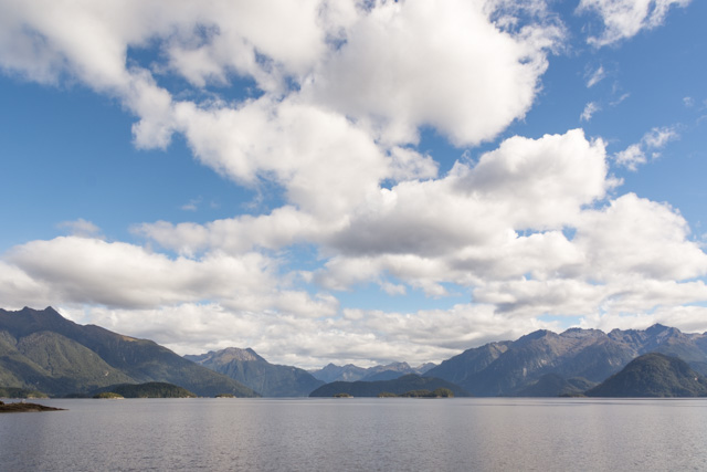
Every lake in New Zealand seems to have its own record – Manapouri was the deepest, then another lake claimed that title but modern soundings suggest Manapouri is the winner. The lake has had many names; the Maori originally called it Lake of Much Rain, it was given its current name by mistake by a British surveyor who wrote the name of another much smaller lake on his map by mistake – the mistake became fact. Our boat ride across the lake takes about an hour; the lake has many arms and islands so it’s an interesting journey, even at midday some cloud hangs over the lakeshore in places.
At the end of the lake, another coach and another comedian driver are waiting for us. This road is the only proper road in New Zealand not connected to any others. It was built along the route of a walking track in 1963 to facilitate the construction of a hydroelectric power station under the mountains that takes advantage of the Lake being 178m above sea level.
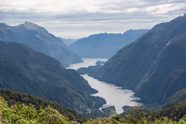
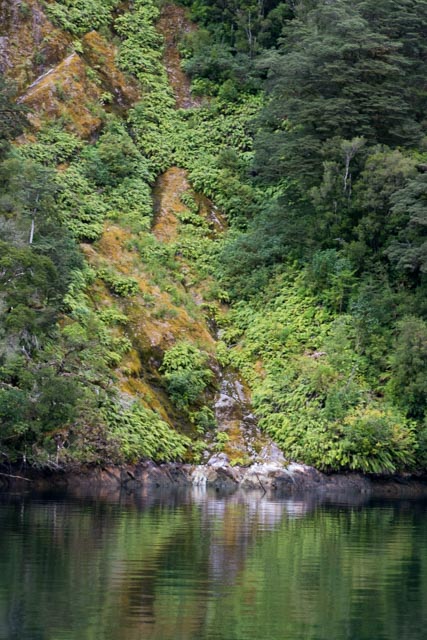
The drive takes us up over a pass in the Southern Alps. On the inland side of the mountains, the forests are all beech trees; on the seaward side the increased amounts of rain change the soil chemistry and allow much more varied vegetation. On the way down towards the coast, we got a first site of our destination, Doubtful Sound, and in the far distance the boat we’d be travelling on. Like all the coastal valleys in Fjordland, the sound is actually a fjord – because it was created by a glacier not a river – but when Captain Cook named it, he was more concerned about whether or not it provided an anchorage than its geological origins, he couldn’t decide hence the name.
We were welcomed onto our boat, the Fjordland Navigator, given a brief introduction then shown to our cabin, which was compact but comfortable.
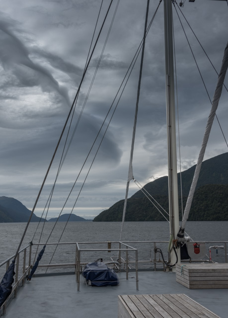
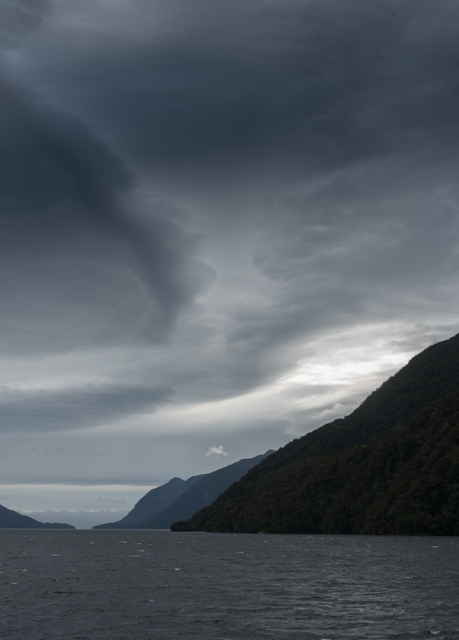
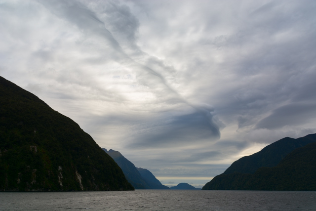
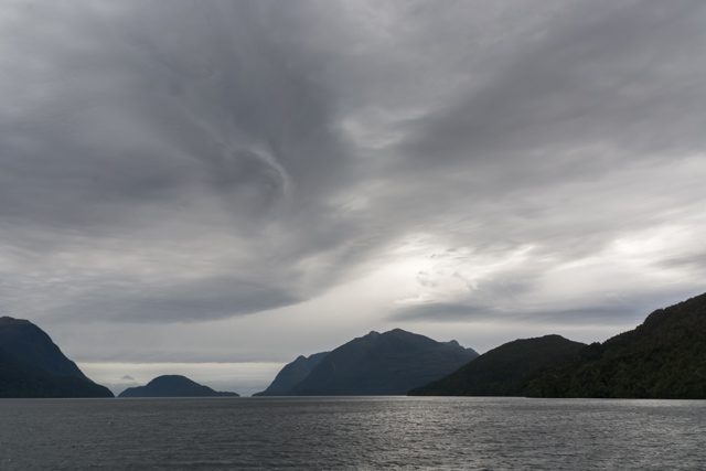
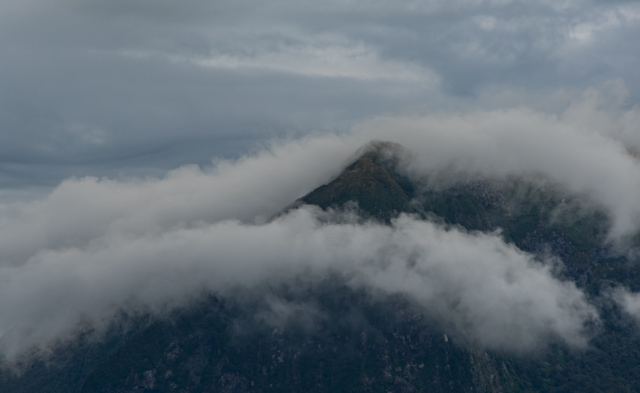
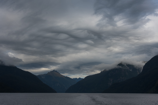
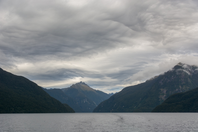
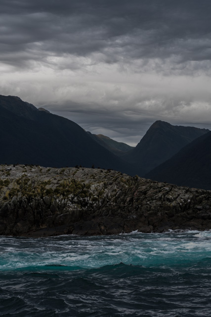
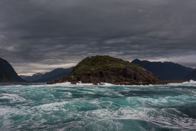
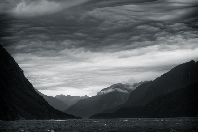
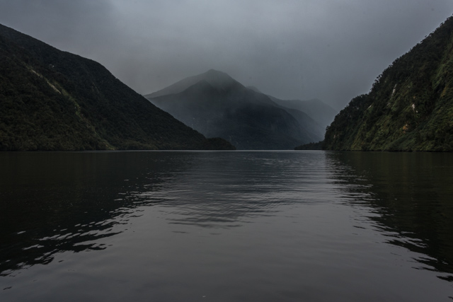
We’d left Manapouri in sunshine but it was now cloudy, but what clouds! As we sailed down the Sound, we were surrounded by mountains and above them clouds with swirls and whorls and patterns everywhere – much better than the clear blue sky we’d had at Milford Sound. The water looked almost black, adding to the mysterious atmosphere.
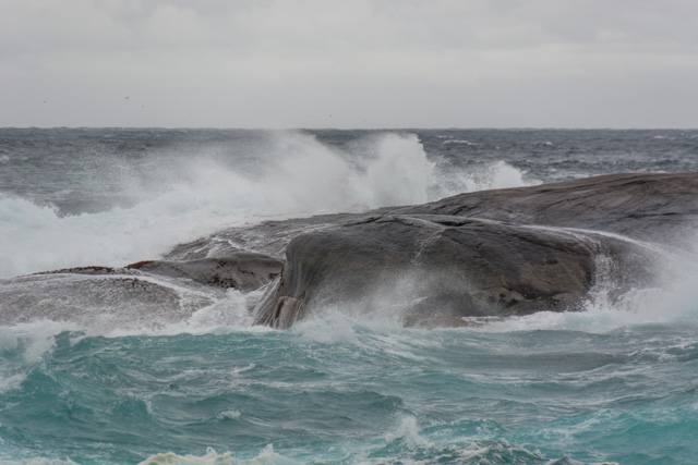
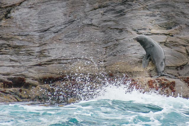
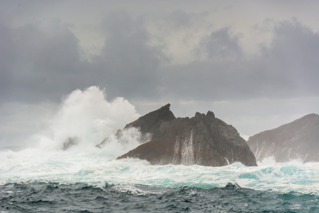
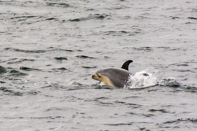
As we sailed towards the Tasman Sea at the end of the Sound, we could see occasional waves breaking up the cliffs and over the rocks in the fjord’s mouth. There’s a pair of rocks out in the ocean, they’re about 12m high, the commentary on the boat told us they’d occasionally seen waves roll over them. We went out as far as a couple of small islands that have New Zealand fur seal colonies on them; at this time of year it’s just mothers and pups. Unfortunately the Fjordland penguins are all away in the open ocean at this time of year so they will have to wait for another visit. The boat returned to calmer waters and took a left turn into Thompson Sound this is a known location for a local pod of bottle-nose dolphins, we saw them almost immediately, 15-20 spread across the mouth of the inlet, one came very close to heck us out – appearing from nowhere out of the dark water then swimming under the boat. A little further up the Sound we saw what looked like more dolphins from a distance but turned out to be a troup of Tuna jumping from the water. This excited a lot of seagulls but the fish were far too big for them to take.
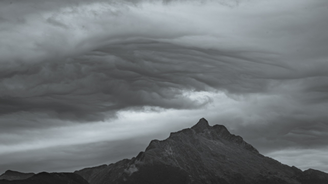
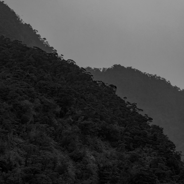
The boat moored in a small side arm that provided sheltered place to stop for the night, near Precipice Cove. There were options to kayak, take a small boat along the shore or swim. We opted to stay on board and enjoy the scenery from the top deck. It was very atmospheric, the clouds were closing in around the peaks and rain was approaching from both sides. Auckland gets about 1.6m of rain per year; Manapouri about twice that and the Fjordland coast gets over 9m. Warm air from Australia picks up moisture from the Tasman Sea; as soon as it hits the coast it rises, cools and dumps most of it. January 2017, approaching mid-summer, had only two dry days.
The special in the bar was a Fjordland Blue Duck vodka so we had to try that – the pure water apparently gives it a very clean taste, we liked it – a lot. Dinner was a buffet, plenty of choices of vegetables and salads for us.
Florence retired to bed with her book; I went to a short presentation about the Flora and Fauna of the region by the boat’s resident naturalist.
What variety of colours in the churning sea. Wow.
Nobody minds those types of clouds. cloudbusting. 9m of rain sounds pretty serious. Another astounding day.
Stunning place ! Thanks
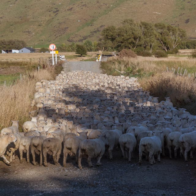
So that’s where all the sheep are– I liked the one earlier
on a stool drinking tea.Am trying to keep up–looks a bit
grim but great pictures.
Sometimes nothing but grim will do.