A Town Fit For A Queen

Today is changeover day. We left our AirBnB this morning and moved a few miles down the road to join our Landscape Photography tour.

We left the house right on 10:00 and I struggled down the hill with my ever-increasing number of bags. It’s only a few stops on the bus to our new hotel and we have bus passes for the week.

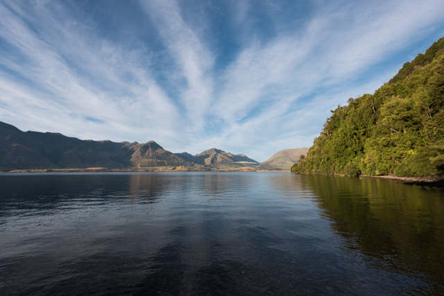
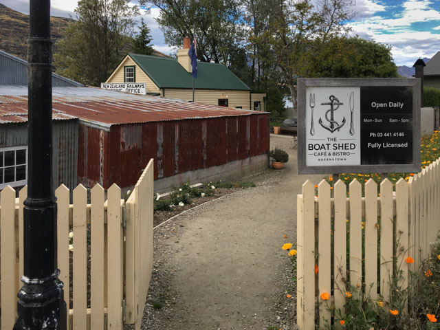
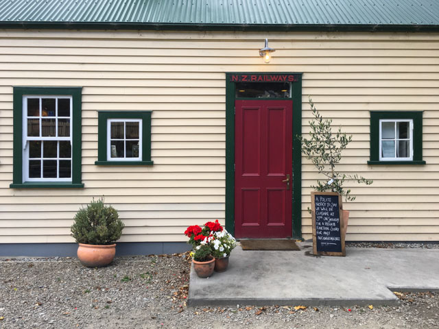
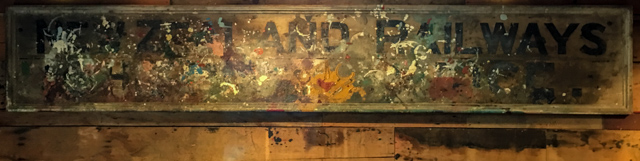
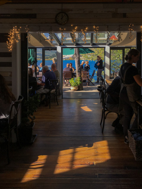
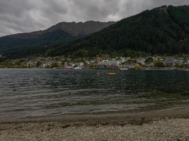
Our room wasn’t quite ready so we left our bags and walked down to the nearby Boat Shed café. The café is collection of old buildings that have been moved to a lakeside location. The main building is an old railway booking office; it’s constructed from clapboard, similar to many buildings in southeast England.

We had our usual flat whites and enviously looked at other people’s food. We weren’t in a hurry and the sun had come out so we gave in to temptation and had an early lunch – poached eggs with spinach and avocado for Florence and a quinoa salad for me.

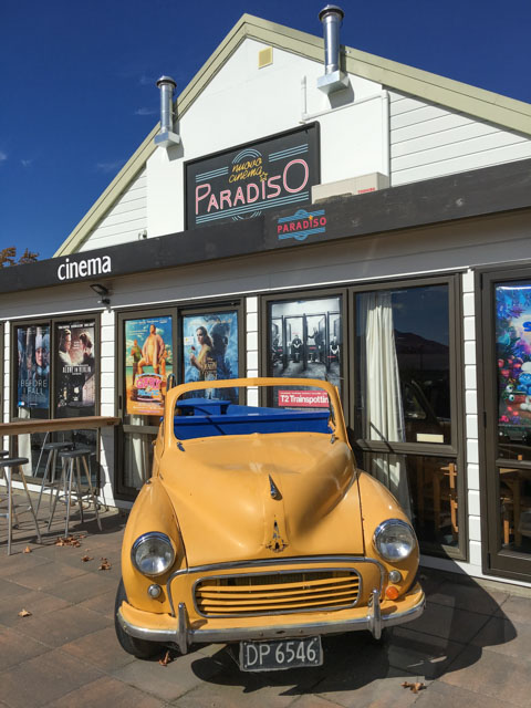
I had some last minute shopping to do for our trip and Florence needed a haircut so we took a bus back into Queenstown. I quickly found what I needed and had an hour to walk round the town and have a closer look at a few buildings. It was a warm sunny afternoon, crowds wandered around the waterfront, arriving or departing on pleasure boats or looking at the toot stalls. A covers band played a Crowded House song – original choice – if I came from here I would leave the weather at home!

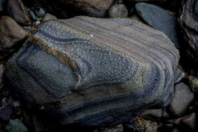
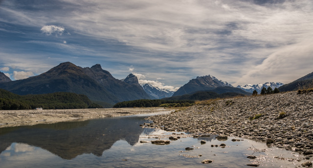
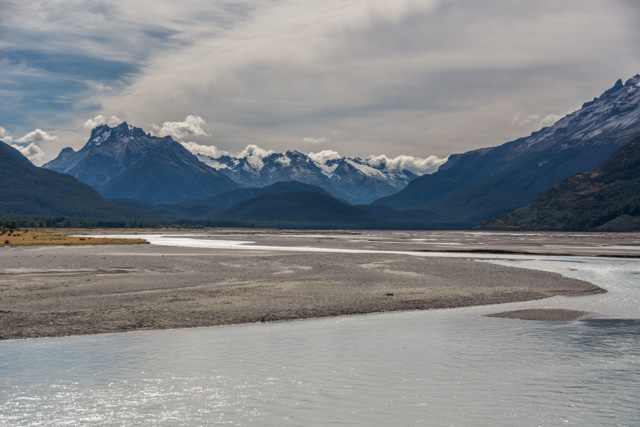
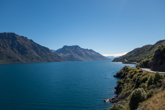
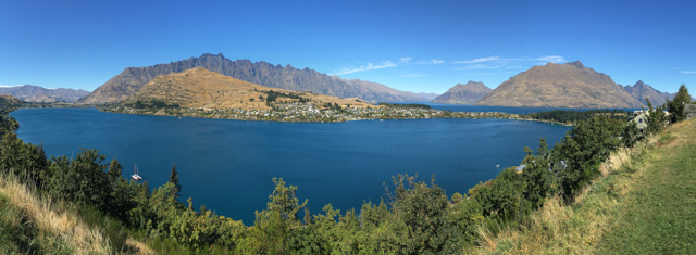
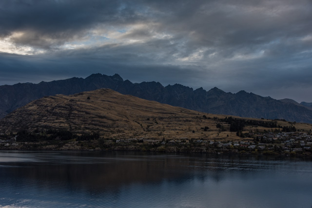
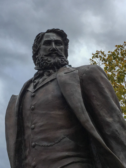
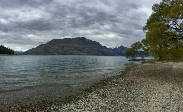
Before the town existed, the Maori fished in Lake Wakatipu and collected Greenstone from the area. The first European settler was William Gilbert Rees who set up a sheep farm on what is now the centre of town. Fortunately for him, gold was found in the area in 1862 and his farm was purchased for £10,000 to provide land for the town. His statue on the waterfront doesn’t look as happy as you might expect. Origins of the name are vague, either it was from Irish miners’ links with a town back home renamed to Queenstown in 1850 to honour Queen Victoria or because it was described as a town fit for a Queen. Or both. Or neither. Tourism came early to the town and never left; early in the 20th century there were steamers on the lake and tearooms on the shore. It’s now a fast-growing town of 14,300 with an international airport.

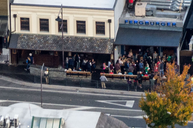
First stop on our photography tour was the Queenstown institution Fergburger. There is always a queue down the street; they churn very good burgers from a menu of about twenty variations. We shared a falafel one called Bun Laden, very tasty.

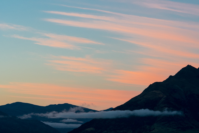
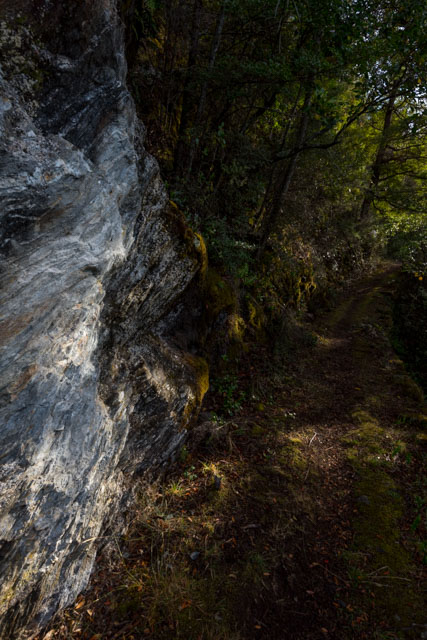
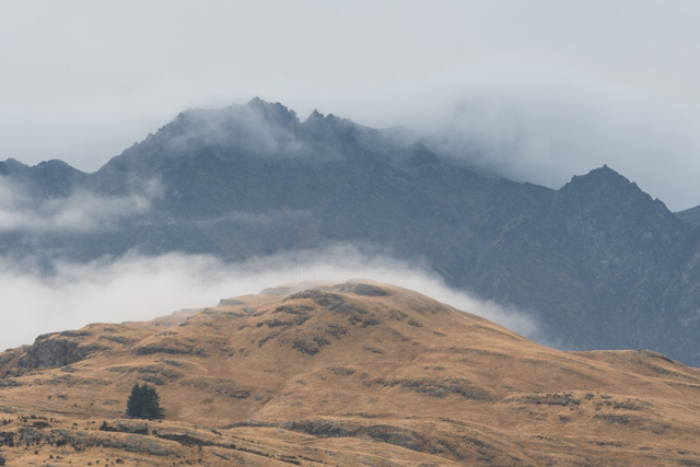
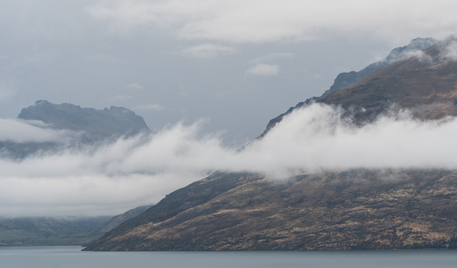
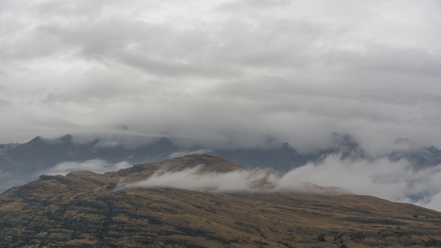
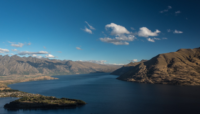
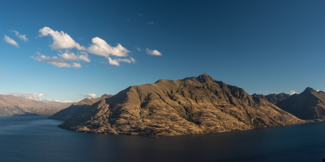
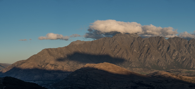
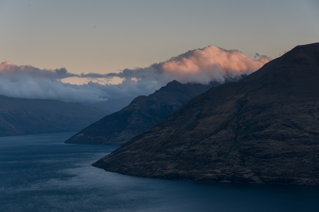
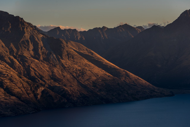
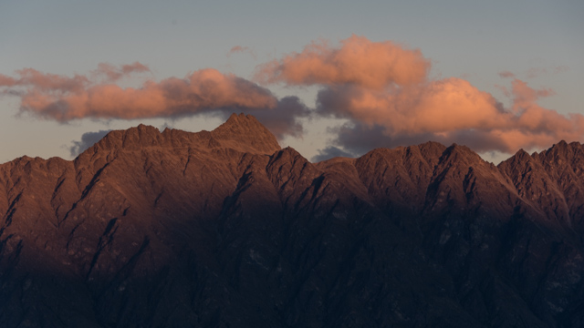
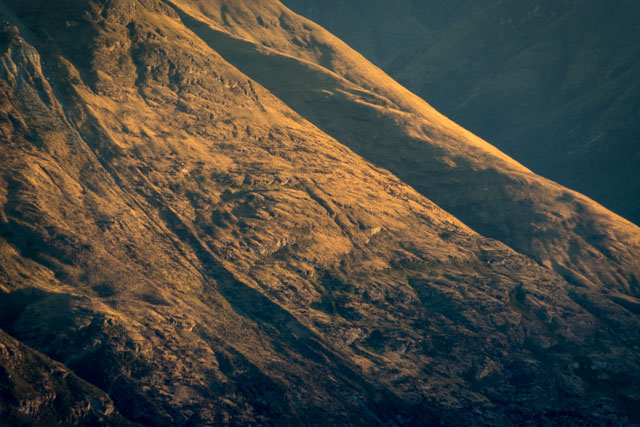
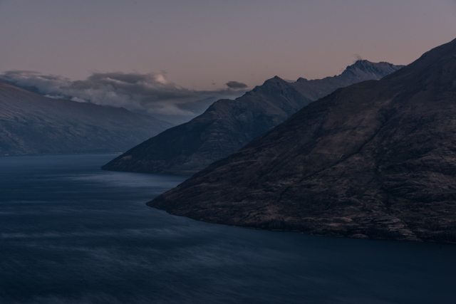
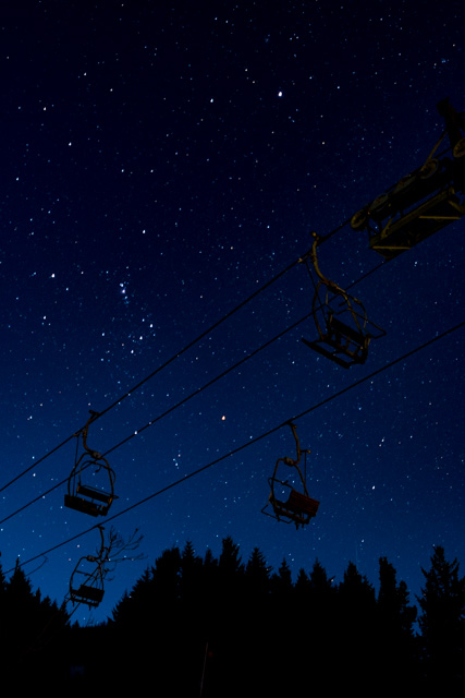
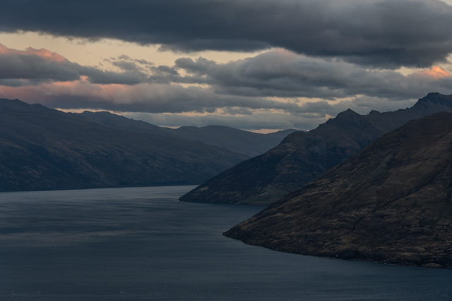
We then took the gondola to the top of the hill overlooking the town to watch the sunset and try and photograph the town at twilight. A combination of wind, a lot of visitors and a private function closing part of the viewing platform made it difficult to get any decent pictures.

We have a 5:15 start in the morning so early nights all round, at least we’re helped by the clocks going back an hour.

Enjoy the silence

The alarm this morning was the captain switching the motor back on.

It was still very dark outside, and on our way to breakfast we could only make out shapes nearby. Moody mountains, only slightly backlit. I would happily stare at this scenery all day.

We hurried over breakfast – it was buffet-style: cereals, fruit and cooked breakfast with juice and tea/coffee – and went to hang around outside our cabin. The walkway is protected by the deck above and so it’s a great place to take photos without getting too wet… for the rain we were expecting had arrived during the night. The arrival of daylight gave us a few minutes of pink hue in the sky.

Overnight, the whole place was transformed. Where yesterday we were looking at hills and rock faces, this morning we had literally thousands of waterfalls. Small, long, short, fat, thin, slow and furious.

It was majestical; we didn’t know where to look. We kept hopping from port side to starboard side.

From Precipice Cove, we headed back into the sound and popped into Crooked Arm. The waterfall there was mighty impressive.

The engine stopped, and we were able to enjoy five minutes of pure silence. Something that is so rare to get nowadays. Nothing but an amazing landscape to admire, the sound of rain and our thoughts. Priceless.

Too soon, we got back to Deep Cove. As we got off the boat, the whole crew was ashore bidding us farewell.

We got the bus back to West Arm, the journey seemed a lot quicker this morning, and the lack of commentary on the bus helped as well.

Waiting for our boat back to Manapouri, I found a little track sheltered by large trees from the drizzle and amused myself by taking close-up photos. Everything comes to life with the rain.

As we got away from West Arm. The rain slowly stopped and we were able to get on the top deck.

The bus waiting for us took us to Te Anau where we’d get our transfer bus back to Queenstown. With 30 minutes on our hands, we went to Takahe Café for lunch, and used their good connection to download a couple more BBC programmes.

The journey back to Queenstown took us back via the same road as yesterday. We’re becoming extremely familiar with that road, and we now know all it’s nooks and crannies.

Our customary stop was in Athol. Rather than go to the café, I explored the other side of the main street. I walked around the small wooden-clad Anglican Church and the latest oddball fence – this one being a bike fence.

A mystery has been solved. There are many more sheep around nowadays, and that’s because the farmers have been bringing them down from the mountains, with the sheep dogs earning their keep.

We got back to the AirBnB just before 4pm. I have been fascinated by the gold rush, and then the early settlers and you don’t have to dig too deep to bring some of these great stories to life. Our taxi driver told us that his mother was from London. She came over with her mother in 1918, age 10, to be re-united with her father after six years. Once in New Zealand, she had to work at her father’s store and was told she wouldn’t go back to school. Undeterred, she became a successful business owner.

We spent the evening doing the washing and sorting our bags out. We’ve leaving the comfort (and the views) of our AirBnB tomorrow for life back on the road.


Cloud Spotter’s Guide

One day we won’t need an alarm clock… but that day isn’t today. Our taxi collected us at 8:40 to meet a coach to take us to a boat to another coach to a boat; explanation to follow.

The Real Journeys coach arrived about 9:00 to take us to Manapouri, about 150km south west of Queenstown. Their coaches are designed for sightseeing in mountainous areas, they have windows in the roof, the seats face slightly outwards and the whole bus is wedge shaped so the seat is front is slightly below you.

There are only a few routes in and out of Queenstown so we’re getting quite familiar with them. This morning, we took the road south, along the side of Lake Wakatipu, the way we’d arrived with Flying Kiwi last week.

The driver promised us a café stop on the way – would it be the café in Athol with the nice muffins and excellent coffee? No – we rolled on through Athol and stopped at Five Rivers café a few miles further on, was it the worst flat white we’ve had in New Zealand? Not quite but it was close. The driver gave a non-stop commentary, liberally interspersed with terrible jokes; we both decided early on in the journey that headphones were a better option.

We were early for our boat at Manapouri so we sat around in the sun for a while, watched the ducks and photographed reflections on the lake.

Every lake in New Zealand seems to have its own record – Manapouri was the deepest, then another lake claimed that title but modern soundings suggest Manapouri is the winner. The lake has had many names; the Maori originally called it Lake of Much Rain, it was given its current name by mistake by a British surveyor who wrote the name of another much smaller lake on his map by mistake – the mistake became fact. Our boat ride across the lake takes about an hour; the lake has many arms and islands so it’s an interesting journey, even at midday some cloud hangs over the lakeshore in places.

At the end of the lake, another coach and another comedian driver are waiting for us. This road is the only proper road in New Zealand not connected to any others. It was built along the route of a walking track in 1963 to facilitate the construction of a hydroelectric power station under the mountains that takes advantage of the Lake being 178m above sea level.

The drive takes us up over a pass in the Southern Alps. On the inland side of the mountains, the forests are all beech trees; on the seaward side the increased amounts of rain change the soil chemistry and allow much more varied vegetation. On the way down towards the coast, we got a first site of our destination, Doubtful Sound, and in the far distance the boat we’d be travelling on. Like all the coastal valleys in Fjordland, the sound is actually a fjord – because it was created by a glacier not a river – but when Captain Cook named it, he was more concerned about whether or not it provided an anchorage than its geological origins, he couldn’t decide hence the name.

We were welcomed onto our boat, the Fjordland Navigator, given a brief introduction then shown to our cabin, which was compact but comfortable.

We’d left Manapouri in sunshine but it was now cloudy, but what clouds! As we sailed down the Sound, we were surrounded by mountains and above them clouds with swirls and whorls and patterns everywhere – much better than the clear blue sky we’d had at Milford Sound. The water looked almost black, adding to the mysterious atmosphere.

As we sailed towards the Tasman Sea at the end of the Sound, we could see occasional waves breaking up the cliffs and over the rocks in the fjord’s mouth. There’s a pair of rocks out in the ocean, they’re about 12m high, the commentary on the boat told us they’d occasionally seen waves roll over them. We went out as far as a couple of small islands that have New Zealand fur seal colonies on them; at this time of year it’s just mothers and pups. Unfortunately the Fjordland penguins are all away in the open ocean at this time of year so they will have to wait for another visit. The boat returned to calmer waters and took a left turn into Thompson Sound this is a known location for a local pod of bottle-nose dolphins, we saw them almost immediately, 15-20 spread across the mouth of the inlet, one came very close to heck us out – appearing from nowhere out of the dark water then swimming under the boat. A little further up the Sound we saw what looked like more dolphins from a distance but turned out to be a troup of Tuna jumping from the water. This excited a lot of seagulls but the fish were far too big for them to take.

The boat moored in a small side arm that provided sheltered place to stop for the night, near Precipice Cove. There were options to kayak, take a small boat along the shore or swim. We opted to stay on board and enjoy the scenery from the top deck. It was very atmospheric, the clouds were closing in around the peaks and rain was approaching from both sides. Auckland gets about 1.6m of rain per year; Manapouri about twice that and the Fjordland coast gets over 9m. Warm air from Australia picks up moisture from the Tasman Sea; as soon as it hits the coast it rises, cools and dumps most of it. January 2017, approaching mid-summer, had only two dry days.

The special in the bar was a Fjordland Blue Duck vodka so we had to try that – the pure water apparently gives it a very clean taste, we liked it – a lot. Dinner was a buffet, plenty of choices of vegetables and salads for us.

Florence retired to bed with her book; I went to a short presentation about the Flora and Fauna of the region by the boat’s resident naturalist.

Cessna C172-ZK-EKH

Another early start this morning, with the alarm going off at 6am for the second day running.

Breakfast, tea and a walk (up and) down to town. There was a chill in the air so the take away flat white was welcome.

We boarded our bus to Wanaka – about one hour away from Queenstown. This was a public bus service but no-one’s told the driver. He’s under the impression that he works for a travel company and he gave us a commentary all the way to Wanaka. We drove through old mining settlements, vineyards and orchards; we could just about see the scenery through the fog. We passed the fruit sellers we’d stopped at so many weeks ago when we first boarded our Flying Kiwi bus, but this time, we stopped across the road at Mrs Jones Fruit Orchard in Cromwell; this being an official stop en-route. We crossed the 45th parallel south – the line which marks the halfway point between the equator and the South Pole.

A few minutes after we got to Wanaka, our taxi arrived and it was a short five minutes journey to Spitfire Lane.

We were at the office of U-Fly… crazy folks who let you fly planes!

I’d opted for a 30 minutes flight and Andy got to come in as passenger. Cessna C172-ZK-EKH is a four-seater plane. Byron, my co-pilot, did the hard work of taking off and as soon as we were at a reasonable altitude, he sat back and handed me the control of the plane.

My journey was over Lake Wanaka and Mou Waho Island – ‘the island, in a lake, in an island, in a lake, in an island in the ocean’. To put it more clearly, there is an island in a lake (Arethusa Pool)  in an island (Mou Waho) in a lake (Wanaka) in an island (South Island) in the ocean!

The experience was intense. I was able to catch glimpses of the scenery but kept thinking: ‘concentrate, you’re in control of this thing’. In truth, the U-Fly folks are not that crazy; they have dual control ready for the pilots to take control at a moment’s notice. Which is just as well, because flying is way way out of my comfort zone, let alone flying a plane.

My circle completed, I aligned the plane to the runway and Byron took control for the landing.

Andy and I swapped places; he barely fitted in the cockpit! Byron got us under way in no time and handed the controls over to Andy. This was a longer flight (Andy’d picked the 50 minute one) so we were able to go over to Mt Aspiring. Byron’s spotted a couple of people on top on Mt Aspiring, which gave us some great perspective. The other interesting thing was ‘The Neck’, the bit of land separating Lake Hawea and Lake Wanaka. Again, we’d driven on it during our first afternoon with Flying Kiwi, and seeing it from the air was amazing. Without that bit of land, the two lakes would form the biggest lake in New Zealand. We also saw Boundary Creek, our first campsite. I enjoyed being a passenger for this flight; the scenery was incredible – glaciers, glacial lakes and very rugged in places.

I went up to 4,300 feet and Andy up to 10,500. We now have certificates congratulating us on taking our first steps towards becoming pilots.

Byron was headed back to Wanaka to grab lunch and he kindly gave us a lift back. We said our goodbyes and headed to Francesca’s Italian Kitchen. We made the most of the weather and sat outside. We couldn’t have picked a better day for the flights.

With our bus back to Queenstown at 3.45pm (the last possible departure time), we explored Wanaka’s outdoor clothing shops as we need some waterproof footwear for next week. Andy didn’t find anything; I got some red wellies 🙂

The other must do thing in Wanaka is to watch a film at Cinema Paradiso – a Wanaka institution. With no late travel options back to Queenstown, we popped into the cinema hoping to get a look at the screening rooms.

The journey back was lovely; the bus took a different route. This means we got to see Cardrona where there is a whisky distillery and an infamous South Island site: the Cardrona Bra Fence. That’s right, a fence covered in bras. Four of them suddenly appeared between Christmas and New Year in 1999 and now, it’s reckoned that numbers are into the thousands.

We asked the driver to drop us off at the Frankton Hub, and walked to the Frankton cemetery. This old cemetery was established near what was the first local hospital (the building no longer exists). It tells tales of miners killed accidentally on the Shotover River and a poor chap from England who died from diarrhoea.

We were lucky in that we only had to wait a few minutes for the route 11 bus to our stop. We discovered a shortcut to the flat – instead of a long steep curvy incline, we have a series of steps. Hard work, but much much quicker.

Sitting on our terrace, with a glass of wine in our hands, we looked at each other and smiled.

We flew a plane today.

Paradise Found

It was dark when my alarm went off this morning. I made some breakfast and we had quick showers. Just time for a picture of the first light hitting the clouds over the lake before our ride for the day arrived.

Jenny is from Private Discovery tours who specialize in guided trips around the Queenstown area. She was born in Dunedin and has lived most of her life in Otago so she knows the area very well; every time we passed a valley or river she’d walked it, cycled it or kayaked it.

We left at 8:00. Our first stop was at Bobs Cove, a short way up the lake from Queenstown. We walked through some thick woodland down to a small stony beach for some great views of the lake in the morning sun. We could hear a lot of birds in the trees; we walked along the path behind the beach to try and see some of them. We’d heard a few Tui around New Zealand, eaten at the Fat Tui burger bar and drunk a Tui beer but this was the first one we’ve seen. They have a beautiful song and this one had a lot to say, although he was close by he was determined to stay in the shade of the branches. We also saw a South Island Robin and some Fantails – a good omen.

As we turned north towards Glenorchy round a kink in the lake, the mountains of the Southern Alps came into view in the distance. We stopped at a couple of viewpoints to see them; one high up above the lake and one on another small beach. Glenorchy itself is a small town that is growing rapidly as an overflow from Queenstown. It has some nice looking cafés, shops and restaurants, Florence found time to do a bit of clothes shopping while Jenny collected our lunch.

We then headed into the area beyond the lake where two large rivers – The Rees and The Dart – have huge stone and gravel deltas. We went off road to have a look at Lake Reid, a small lake with a large waterfowl population, and then climbed up a dirt road to stop for lunch overlooking Diamond Lake. It was a great view with the lake in the foreground and the mountains beyond. Our Land Rover coped well with the lumpy fields, dirt roads and dust. Private Discovery have an arrangement with a number of local farmers to allow them to drive on private land to get to places other tours don’t, this means a lot of getting in and out to open and close gates and in one instance walking over a bridge that isn’t sufficiently safe for us to be insured if we were in the car.

After lunch, we headed to Paradise Valley; we’d seen some photos of this area when we were researching New Zealand and that led us to today’s excursion. Beyond the valley, we saw the huge Dart River Flats then crossed the Dart River to Kinloch on the opposite side of the lake to Glenorchy. We stopped for some pictures on the long bridge crossing the Dart for some pictures, there isn’t much water in the river at this time of the year, it’s much fuller in spring. Jenny showed us the level of the floods in the early 1990s; these filled the valley and almost came up to the road. Only the Shotover River flows out of Lake Wakatipu, it couldn’t cope with the volume of water coming in from the mountains so the lake level rose and Queenstown was flooded enough for people to kayak down the main street.

We reluctantly returned to Queenstown around 4pm. The scenery around Lake Wakatipu is varied and lovely, this was a great way to see a lot of it.

We had a light dinner followed by two local cheeses and some Pinot Noir.

All that glitters isn’t gold

When the alarm went off, Andy went off to make tea. The morning light was just hitting The Remarkables. We had to tear ourselves away – breakfast, showers and a brisk walk to town. We forbade ourselves to look at the mountains; we had a bus to catch at a very specific time.

We bought a weekly bus pass, and boarded the 10:35 bus to Arrowtown.

It’s a short journey, about 25 minutes. The town is rich in history. It’s located next to the Arrow River. Gold was discovered there in 1862 and that was that. Thousands poured into the area, and the settlement grew into a small town.

Now, it is a pretty residential town and very touristic. There are about 60 preserved buildings used by European settlers, and a Chinese settlement. We learnt in Dunedin that the Chinese had been invited over to work the claims, once the majority of the gold had been claimed and miners left for the new gold fields of the West Coast. They worked hard and hoped to send back home 2/3 of the money they earned. They never intended to settle in New Zealand. Some went back, many died and were buried in the local cemetery only to be sent back to China much later on as it’s important for them to be interred with their ancestors.

We started with the Lakes District Museum and spent a good 90 mins there. It’s full of historical artefacts and displays focusing on the  pioneering days of the European settlers and gold-miners. The town grew out of need – a bank, a prison, a school, a newspaper.

From there, we followed our guidebook and looked at the buildings on Buckingham Street. Most have been modified slightly or rebuilt after a fire but they retain their character and from them, you still get a feeling of Arrowtown as a gold mining settlement, if that makes sense.

Our early lunch was a vegetable pie from Arrowtown Bakery. Tasty!

We were keen to visit the Chinese Settlement when it was quiet. The buildings – either original or restored – are a little out of town. Turns out that they kept to themselves… mostly because they were not accepted by the settlers and were often subjected to racism. The exception was Ah Lum. He became a local hero after he saved the life of a European miner who was drowning in the Shotover River. He could speak English and was a well-respected leader in the Chinese mining community. He served as an interpreter between the Chinese and the Europeans. He owned a store from 1909 which was used as a bank, a place for socialising and as accommodation for both travellers and visitors. Records show that the Chinese were big spenders. They worked the river hard and managed to get a lot of gold out of it. They spent their hard-earned cash on luxuries and had a very varied diet. They also gambled and smoked opium.

Dudley’s Cottage is the oldest surviving cottage in Arrowtown. It was built in 1862 and it’s now a cafe. We stopped there for coffee… and I took a speedy gold panning lesson. I struck gold – alluvial gold, but gold all the same. I have a certificate and a vial with gold dust to take home. I took my spade and pan to the river and occupied myself for about 90 mins. I dug, I panned, I rinsed. On and on. So absorbing. I saw glitters but my co-ordination was a little all over the place so when only gold should have been at the bottom of my pan… I had sand. And the sandflies were atrocious.

My limited time panning the river told me that it’s hard work, and tough on your back. It did give me an appreciation of what the miners went through. It is also another tick on my ‘must do’ list.

Andy was busy taking photos of the river, but the sandflies got the better of him so we walked back to town.

Next, we visited the cemetery (which had many old graves) and the war memorial for a bird’s eye view of Arrowtown. We continued with our walk and took in the three remaining churches (the Methodist is now an architect office), the jail (before it was built, prisoners were shackled to a log) and the police station. We walked down the avenue which has about 10 preserved buildings – mostly cottages.

Too soon, it was time to get our bus back to Queenstown. I stopped in Frankton to go to Countdown (more supplies for the week). Andy carried on to the Hilton where he collected a bag we’d left in storage.

On my way to the bus stop, I managed a few minutes in the Frankton cemetery which is the oldest one in the area. I wish I’d stayed longer… but I was due to meet Andy back at the bus stop.

Reunited, we got another bus back to the bottom of our hill. I managed to get a lift from a very kind man. Andy had stayed behind to take a few photos.

Dinner was lovely and perfectly suited our bottled of Central Otago Sauvignon Blanc.


Slow News Day

We had big plans for today: laundry, charging, downloads and back-ups.

It’s a grey and showery day outside so we decided to stay in for the day and do all our chores. This worked up to a point but the view across the lake to the mountains beyond has been majestical all day so we haven’t got quite as much done as we might have. In fairness, we picked this AirBnB because of the views. The clouds have been moving around the hills all day; the view’s different every few seconds.

We can also see the runway at Queenstown airport; it’s surprisingly busy – light aircraft and helicopters fitting in between the airliners.

We stopped watching the mountains at 14:45 and watched out for the Flying Kiwi bus leaving town. It felt a bit odd watching them heading out on the journey that we started 4 weeks ago. The first campsite tonight is really lovely, next to Lake Wanaka. It doesn’t look like they’ll have quite the sunset that we did.

We watched a bit of TV on our laptops this afternoon – it took me 90 minutes to get through 45 minutes of a program because of the constant interruptions from the clouds.

The last meal I cooked was in Napier about a month ago – pasta, halloumi cheese and Pinot Noir. Without thinking about it, we ended up with the same meal today (something quick and easy). We have got a week here so there will be a bit more variety. I’ve bought some feijoas to keep my vitamins up.

The gold rush

We made the most of our first morning of freedom by sleeping in. We walked to town soon after 10:30am.

We’re staying just on the outskirts of Queenstown; a good twenty-minute walk away. There is a steep hill between our AirBnB and town so no matter which way we walk, you can’t avoid it. On the way, we noticed a couple of houses with Irish and New Zealand flags displayed in the window.

We walked through the cemetery nestled at the base of Queenstown Hill. The ancient headstones tell stories of settlers from Scotland, England and mostly Ireland, which explains the flags in town. According to the information panel, many descendants still live in Queenstown nowadays.

Queenstown is now known as an adventure town but it owes its development to schist rocks, which contain deposits of gold. From 1862, when gold was first discovered here, thousands of people made their way here to make their fortune. The schist also provided the early settlers with building materials for houses, bridges and fences.

The Arrow and the Shotover rivers proved rich in gold and led to the establishment of nearby settlements. Two men stuck gold at Arthur’s Point – Thomas Arthur and Henry Redfern took 210 ounces (6 kgs) in just eight days. Some men decided to make their money by stealing the gold and did not hesitate to commit murder to acquire it. Gangs would often use force to chase people away from the best claims.

A few headstones tell of accidental mining deaths. Some of the earliest graves are unmarked and unrecorded; it is thought that they are graves of Chinese miners. In the Toitū Otago Settlers Museum in Dunedin, we’d read that the Otago leaders had invited Chinese miners to come and work the post-rush Otago minefields in 1865. Many thousands came over and by 1871, 4,200 Chinese were living in Otago.

I’m finding all this gold rush history particularly interesting, especially as I’m currently reading The Luminaries.

We crossed the road and had a tasty brunch at Bespoke Kitchen. From there, we went to Fresh Choice and Raeward Fresh and got supplies for the week.

We rushed back to town for our 3:20pm pick up. We drove out of Queenstown for about 45 mins, first along the road and then along a dirt road, which was built originally to enable supplies to get to gold prospectors. It is one lane with only a few passing points, which made it interesting as vehicles came from the other direction. It is a world famous road; there are no safety barriers, just sheer drops down the canyon. The scenery was beyond spectacular.

Skippers Canyon was also rich in gold and there was a mine there until the 1990s. There are rumours that gold is still to be found there but this was not the reason for our trip there.

We boarded a jet boat for 30 mins of pure fun. The jet boat skimmed over the water; at times we were going at 87kms a hour. The water is cold and when the sun catches it, it is the purest emerald colour. Our driver Ben did a few spins and drove close to the canyon wall. We had the biggest grins on our faces by the time we got back in the bus. For the journey back, we moved seats so we’d be on the canyon side again. Those three hours were my best in New Zealand so far.

Back in Queenstown, we went straight to The Winery. We got issued with two tasting glasses and a card. The idea is that you slot the card in a dispenser and you get a choice of three sizes – sample, small glass and large glass. There are various dispensers throughout, one per grape – pinot gris, chardonnay, sauvignon blanc, etc. The biggest by far is the Pinot Noir. What an amazing place! You get to taste a variety of wine – all from New Zealand of course. And the prices are reasonable.

An hour later – and a combined eight samples later – we walked to Vinnie’s for the farewell group meal.

It’s odd to think that the bus is leaving tomorrow, from where we first boarded it, and we won’t be on it.

Farewell to Old Blue


Today is the day we say goodbye to our bus after 5,500kms – actually three different buses but this one’s our favourite.

We had a slow start in Te Anau. We weren’t leaving until 11:00 so we slept in until 8:30 – wild – had breakfast and checked out. It was a very nice room so it would have been good to stay longer.

It was only about 100kms drive to Queenstown, great scenery all the way.

We stopped in Athol for some very good flat whites and couldn’t resist a raspberry muffin to go with them. After Athol, we drove long the bottom edge of the Remarkables range – apparently named because on finding that the ridge line ran almost exactly north to south, a British surveyor in the 1800s declared them ‘remarkable’. The road also skirted Lake Wakatipu. This is a long thin lake shaped lake a stretched out letter ‘Z’. The Maori tradition has it that the shape is that of the evil giant Matau sleeping with his knees up. It’s the longest and deepest lake in New Zealand and the third largest. It’s also the second purest lake in the world – the water is 99.9% perfect, better than bottled water.

We stopped for a brief photo-stop before the final leg into Queenstown.

We were dropped off at a bus stop just outside town to make our way up to our AirBnB apartment, home for the next week. We settled in quickly then went into town, had a quick wander round then shared a pizza at the Fat Badger Pizza emporium. We were in a hurry so we could make it up the Skyline Gondola to the observation point 500m above the town in time for sunset.

We watched the light fade over the lake then waited around for the stars to come out. The Milky Way was clearly visible. The familiar shape of Orion was easy to pick out but the opposite way up to what we’re used to.

Iconic Milford Sound

We stayed the night at Gunn Camp. Our little tiny cabin was basic; all the cabins in the camp were used by people who built the road down this part of NZ and now they’re part of a cool campsite. The generator was switched on around 7am. Staying in our cabin provided us with a decent mattress, but the walls were so patched up that it retained no heat. The morning was so cold, you could see your breath in the air.

After breakfast, we made our packed lunches for the day and boarded the bus.

Twenty minutes down the road, we stopped at The Chasm. It’s a 20-minute loop walk through the forest to the river. The stones have been shaped by water over many years and the river flows through the holes. The colour further down is a deep blue-green.

We drove on to Milford Sound – one of New Zealand’s most famous sights and one who is truly worthy of the word ‘iconic’ according to Lonely Planet.

Our boarding cards for our 90 mins cruise around Milford Sound came with a free muffin voucher; not sure why. Once on board, we headed straight to the top deck and marvelled at the views. It’s definitely one of these sites that make you feel insignificant as human beings. Planes, helicopters, cruise boats and humans pale into insignificance. We saw a variety of rock formations, snow-capped peaks, many waterfalls and some fur seals. The time went quickly and all too soon, we were back on the bus. Thankfully, we’ll have another go in a few weeks. Andy was saying that from a landscape photography point of view, he would have been happy with rain and clouds. I disagree. The sun provided a tiny bit of warmth in what was a cold afternoon.

Three people on the group were then dropped off at the start of the Routeburn track – a two-day walk to Queenstown. The rest of the group were encouraged to walk up to Key Summit – the first hour of the Routeburn walk. The return journey is advertised as taking three hours; we were given two hours. I opted out of the walk as it’s a steep incline and my knee is still sore. I stayed in the bus, made myself comfy and watched a film. On his return, Andy said that I had made the right decision as it would have been too tough on my injury. He enjoyed the views from the top, but added that the walk had been hard.

Back in Te Anau, we checked into our cabin (very nice) and met up with another couple for drinks and dinner. They were celebrating their first anniversary and had kindly asked us to join them for the evening. We went to a bar for a glass of wine first and then crossed the road to The Fat Duck. Te Anau is not blessed with great places to eat. The town only exists because of tourism. Our walk back to camp – all the way across town – was deserted.